Our Flight with
Brian Knight
On October 25, 2015, former
colleague at UTRC Brian Knight flew up to the
Eastern Slopes Airport in Freyberg with passengers
Bob and Deb Haas.
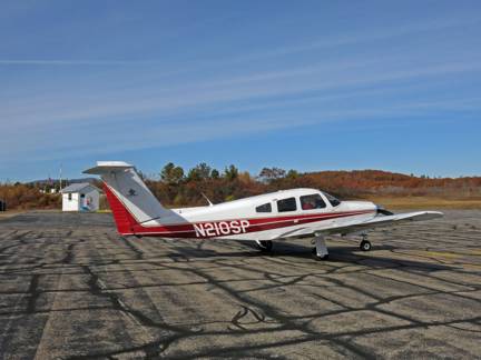
This is the plane which he rented for the day.
I am not sure what this model is, but it is noted
for it’s high tail (which leads to certain instabilities).
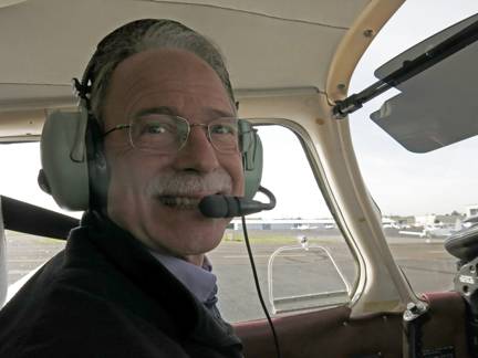
Brian has been flying for a long time. I recall when
we were at UTRC and Brian suggested that he would fly me on a trip to Penn
State. The personnel department frowned on that idea.
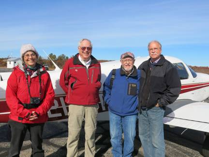
Here was the crew for our flight – except that Deb
Haas was replaced by Wendy. Deb stayed at the airport as we took our one-hour
flight.
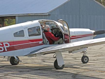
Bob and Wendy climbed in the rear cabin, then Brian
got in the pilot’s seat and I was the co-pilot. There is only one door on this
plane. To say that the quarters were cramped would be an understatement.
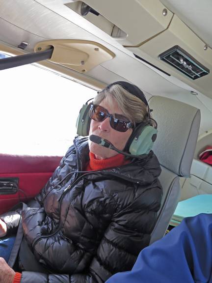
We all buckeled up and were given head-phones so we
could talk to one another over the engine noise.
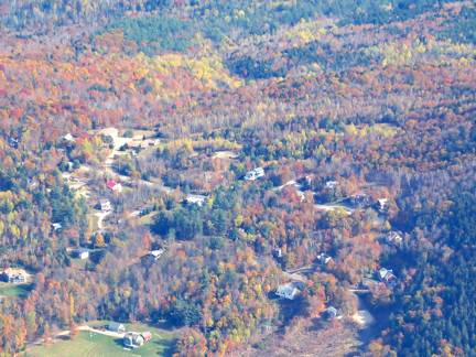
The flight to Jackson took only 5 minutes. Brian
circled the town at 5000 ft three times so we could take pictures. Here is the
Top of Tyrol (at least the populated part) with High Meadow at the bottom of
the picture.
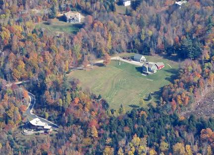
This is a picture of Wildflower Lane with High Meadow
at the top and the Gray’s (formerly the Prinnz’s and Shield’s) house at the
bottom.
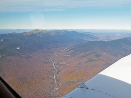
We then followed Route 16 up to Mount Washington. –
elevation 6288 feet. I suggested to Brian that he might want to gain a little
altitude. No problem, said Brian, and he took us up to 7500 feet.
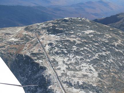
We circled the mountain several times. Here is the Cog
Railway which goes up the western side. The Cog was not running as the season
was over, but we did see a train
(not shown here) which suggested they were workin’ on the railroad.
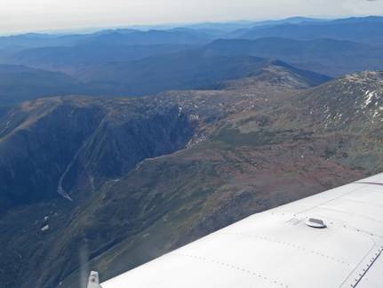
Here is a view of the Great Gulf with the Ridge of the
Caps trail going up the near side. The weather was perfect. I think if there
had been hikers on the trail we could have spotted them.
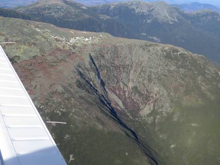
This looks like Huntington Ravine. At the top you can
spot the Auto Road. Just above the ravine you can see a trail to the summit.
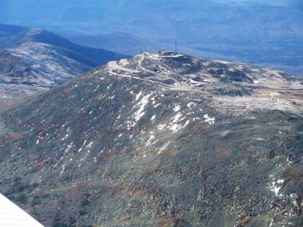
Here is the summit with the parking lots to the left.
Again, the Auto road was closed, but there are people at the Mount Washington
Observatory. You can hike up the mountain at any time, but you can’t buy a meal
at the summit except in the summertime.
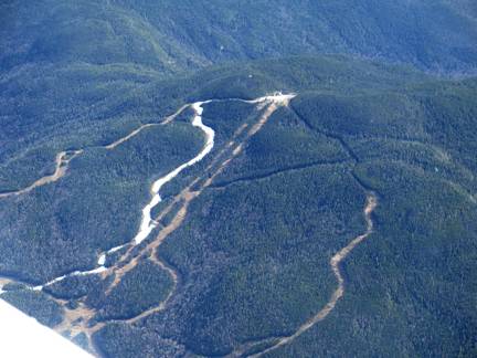
Across from Mt. Washington is Wildcat Mountain. You can see that they have been making
snow on the Lynx Trail. We can see
the top of the chairlift from our deck – notable because of the white color.
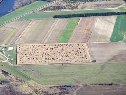
On the way back to Fryeberg we passed over Corn Maze
at Sherman Farm.
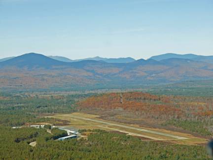
Back to the Easter Slopes Airport. Thank you, Bob Haas, for all the
wonderful photos. (Wendy’s camera lost battery power at takeoff.) And thank you Brain Knight for a soft
landing. And thank you, Deb Hass, for prying me out of my seat.